Defining Line places geo-locked, site-relevant artworks in augmented reality along the Los Angeles River. Including contemporary art and river-related storytelling, this AR exhibition expands the larger Procession project and encourages viewers to continue their education and experience of the river’s entire 51-mile length.
Defining Line is co-organized by Nancy Baker Cahill, Debra Scacco, and Joel Garcia, and presented as part of Procession.
Click here to download and learn how to use the the 4th wall app!
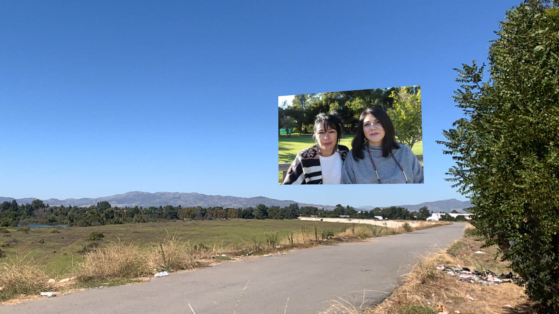
Maria Romero, courtesy of Las Fotos. Tataviam Water Protectors, 2023
Location: Sepulveda Basin
GPS to: Park and Ride, 15400 Burbank Blvd, Van Nuys, CA 91411
The work is located on the edge of the Sepulveda Basin Wildlife Reserve. Park in the small parking area located on Burbank Blvd bordering the 405 freeway. The image is viewable from the beginning of the elevated trail that overlooks the reserve and backs onto the 405 freeway. Tataviam water protectors Caroline Ward and Pamela Villaseñor hover above the mountains, as they work to protect land and water for the next seven generations. The site presents the confluence of both what is and what could be.
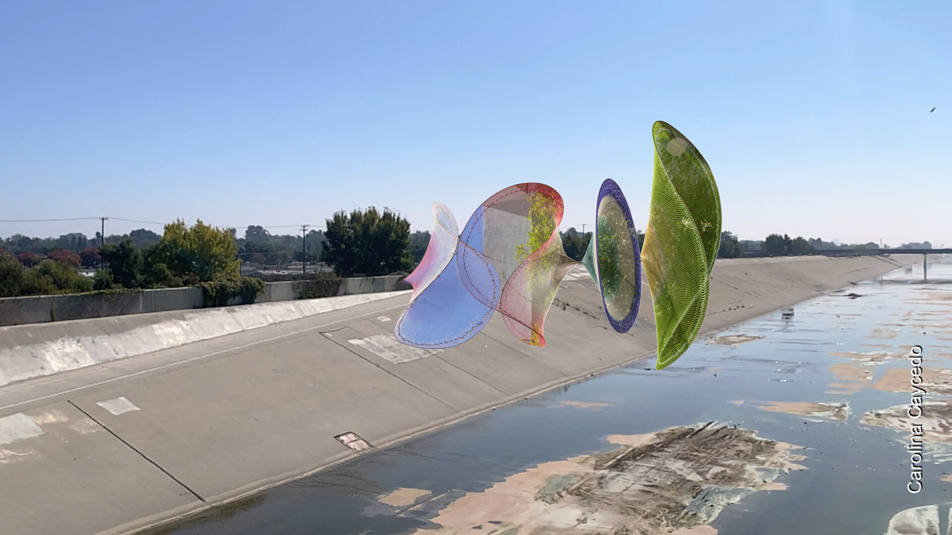
Carolina Caycedo, Curative Mouth, 2018
Location: Confluence of Compton Creek and Los Angeles River, viewable from the southwest edge of the Dominguez Gap Wetlands.
GPS to: C. David Molina Park, 4951 Oregon Ave, Long Beach, CA 90805
Carolina Caycedo’s Curative Mouth features fishing nets collected during the artists’ work in global communities impacted by the privatization of water. Located near the confluence of Compton Creek and the Los Angeles River, it is recommended to view the work after exploring the immediate surroundings, most notably the contrast between the Dominguez Gap Wetlands and the Los Angeles River, with the possibility of witnessing the concrete junction of the confluence itself (rain dependent).
Drive into Molina Park and park at the farthest end. Follow the dirt trail directly in front of you to enter the Dominguez Gap Wetlands. Follow the trail as it borders the Los Angeles River, noticing the change in elevation, the sounds, smells, and wildlife that the wetlands offer. When you arrive at the building situated at the confluence, follow the upward loop to walk back along the Los Angeles River. Notice the change in senses – the difference of walking along the edge of a wetland versus walking along a concrete flood channel. On arriving back at Del Amo Blvd, cross the bridge and point your phone towards the wetland to view Curative Mouth as it straddles the concrete channel and restored wetland area.
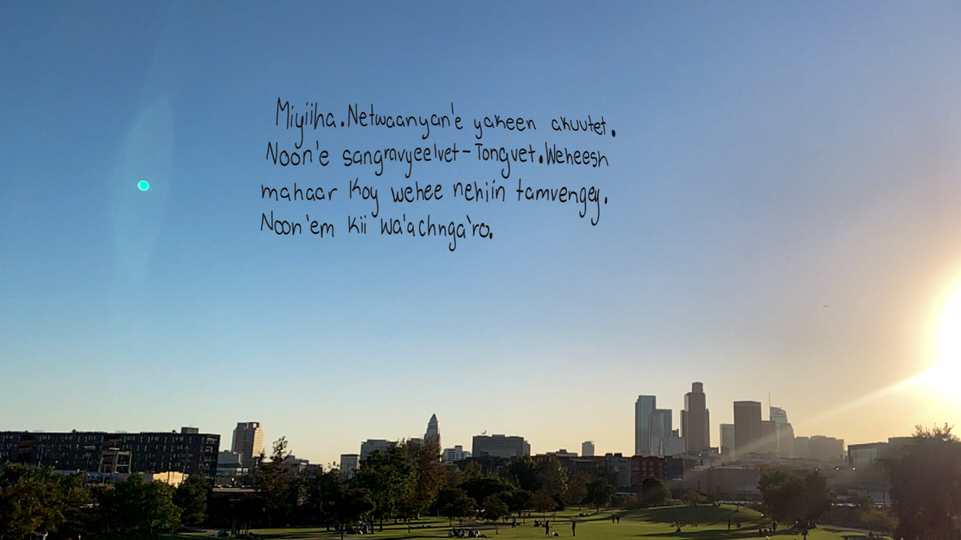
Tongva Elder Julia Bogany and Marissa Aranda, Journey of Visibility, 2018
Location: Roundhouse Bridge at Los Angeles State Historic Park
GPS to: Los Angeles State Historic Park, 1245 N Spring St, Los Angeles, CA 90012
Created in 2018, Journey of Visibility documents a conversation between late Tongva Elder Julia Bogany (1948-2021) and her great granddaughter Marissa Aranda, who was 13 at the time of this interview. The handwriting belongs to Marissa as she introduces herself in her Native Tongva language as taught by her great grandmother. As her words and their voices loom large above the skyline of Yaangna (now contemporary Los Angeles), they discuss the modern identity of Tongva women and intergenerational knowledge.
Gallery